


Steve Larese
Nankoweap Trail: Hiking the Grand Canyon's Most Difficult Trail

With 11 miles of waterless exposure and trails just inches from deadly drops, Nankoweap Trail requires skill and nerve to hike. Here are some details about completing this beautiful yet challenging trail within Grand Canyon National Park.
The Grand Canyon's Most Difficult Named Trail
Waterless. Not suitable for anyone with a fear of heights. Classified as the most difficult of all the named trails in Grand Canyon National Park. This is how the National Park Service describes the North Rim's Nankoweap Trail, and these descriptors aren't hyperbolic. With 11 miles of exposure and a trail that comes within inches of hundreds-of-feet plunges, Nankoweap tests the mettle and skills of backcountry hikers. It has the highest drop of all the rim-to-river trails at 5,640 vertical feet and is suicidal to attempt in the searing summer months. Nankoweap is unmarked and route-finding skills often come into play. It's rare to see anyone else on the trail, cell phones don't work, GPS units are often blocked by canyon walls and help isn't available. But this Native American trail improved upon in 1869 by the Powell expedition for geology studies enchants those who accomplish it with its beauty and rewards, ending with the cool waters of Nankoweap Creek and the Colorado River after a waterless traverse akin to walking the ledges of skyscrapers. Anyone interested in attempting this hike should be in excellent physical condition, experienced in desert backcountry hiking and do much research about what is to be expected along Nankoweap Trail.
Obtaining a Permit
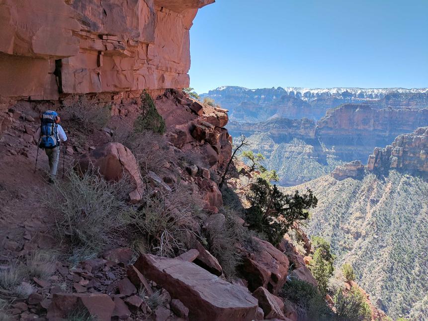
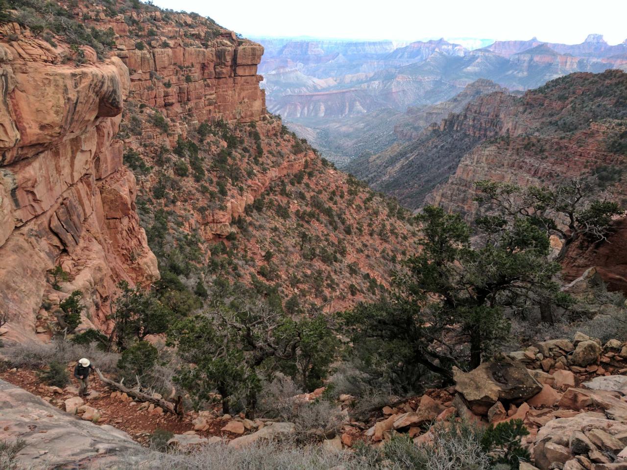
Steve Larese
Much of the Nankoweap Trail skirts cliffs that are hundreds of feet high. Here, Dewey Surby hikes one of the safer sections.
The first step in hiking Nankoweap is to secure a permit through the Backcountry Office at the Grand Canyon National Park. (Click here to download a permit application, then fax it back to the office.) The Entry and Exit Location is section AE9. In a few weeks, confirmation will be emailed with the specific dates of your hike. Permits allow the park service to know who's on the trail, so they can launch search and rescue if hikers are overdue. By staggering access, they also prevent hiker jams on narrow sections of trails and help ensure available camping sites. Many of the recent deaths on Nankoweap Trail happened to hikers who didn't have permits or who hiked outside of their assigned dates.
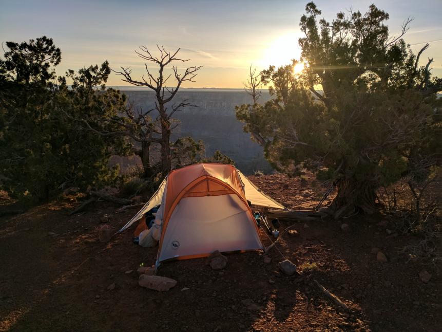
Getting to the Trailhead
Due to snowfall, the Grand Canyon National Park's North Rim is open only from May 15 through October 15. The Nankoweap trailhead may be reached year-round by first hiking Trail #57 through the Kaibab National Forest.
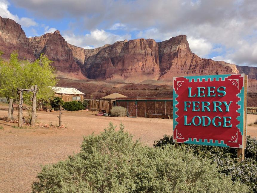
Steve Larese
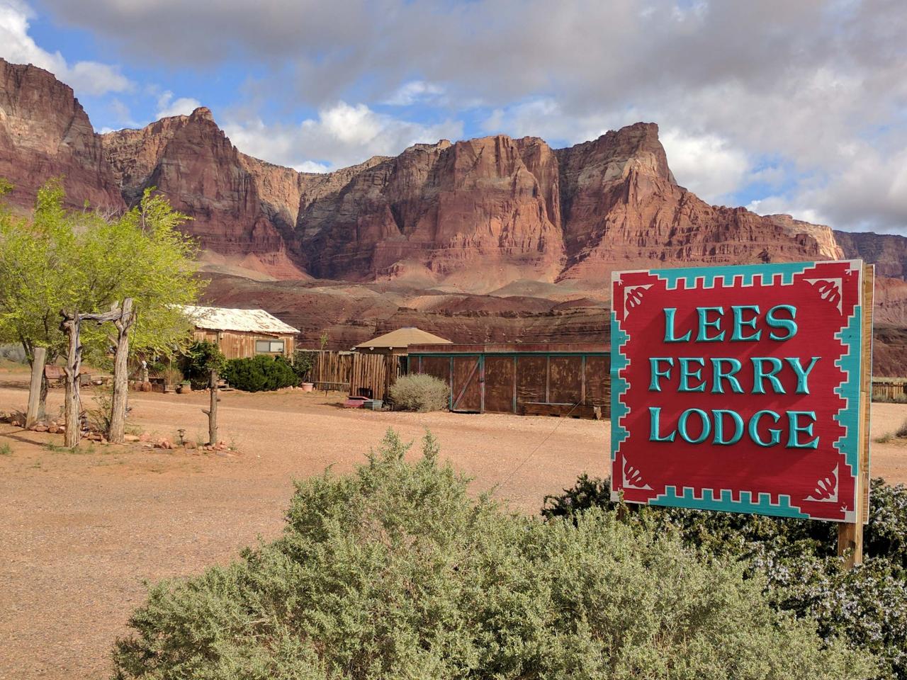
Lee's Ferry Lodge makes a good place to stay the night before embarking on Nankoweap Trail, or hikers can camp within Kaibab National Forest.
There are several motels along US 89A to stay the night before the hike, or you can camp within the forest. From Lee's Ferry Lodge, it's approximately 18 miles west along US 89A to Forest Service Road 8910, also called Buffalo Ranch Road, to the south. From here, it's about an hour and a half drive on a dirt road for 27.4 miles to the parking area. The 2016 Wildcat Fire scorched much of the forest here, burning trail signage that may or may not be replaced at the time of this writing. Having a good topographical map and compass of the area is essential for hiking Nankoweap.
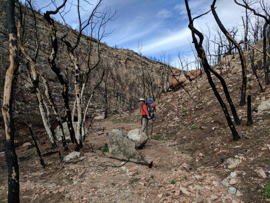
Steve Larese
The 2016 Wildcat Fire burned much of the Kaibab National Forest hikers must pass through before reaching the Grand Canyon National Park boundary and the Nankoweap trailhead.
From the parking lot, it's a 3.5-mile hike through the Kaibab National Forest to the Grand Canyon boundary. The trail climbs to a ridge, then switchbacks down to just above a creek. Do not continue on the trail across the creek; there's a spur to the right that will follow and make several stream crossings before leaving the creek bottom and climbing toward Saddle Mountain. This stream is the last chance to top off water until hikers reach Nankoweap Creek about 10 miles and 12 hours away, and it's recommended that each hiker carries at least six liters of water. At the top of Saddle Mountain at 7,500 feet, you'll encounter signage marking the national park boundary, and you've officially arrived at the Nankoweap trailhead.
The Switchback Down
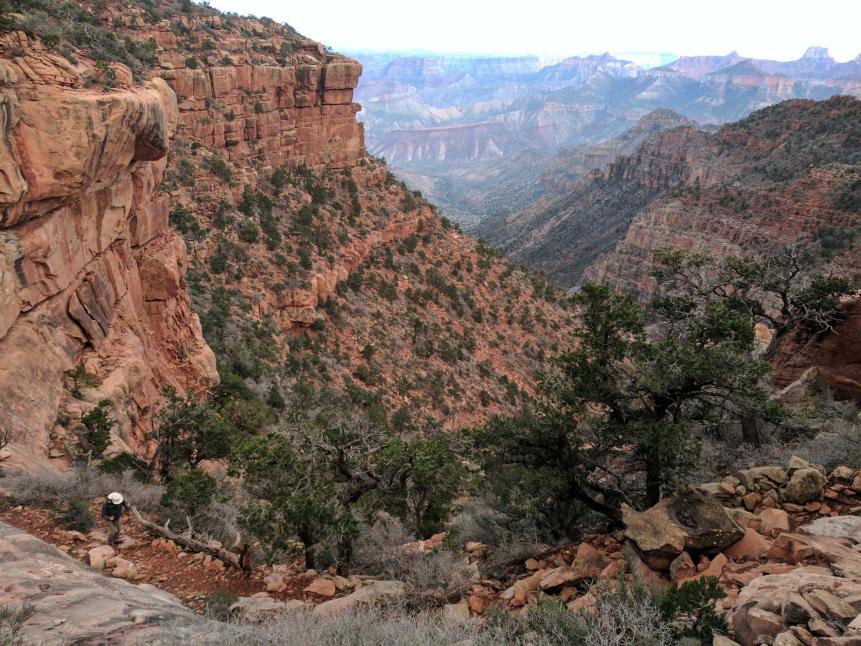
Steve Larese
A hiker in the lower left can be seen making his way down the switchback at the beginning of Nankoweap Trail.
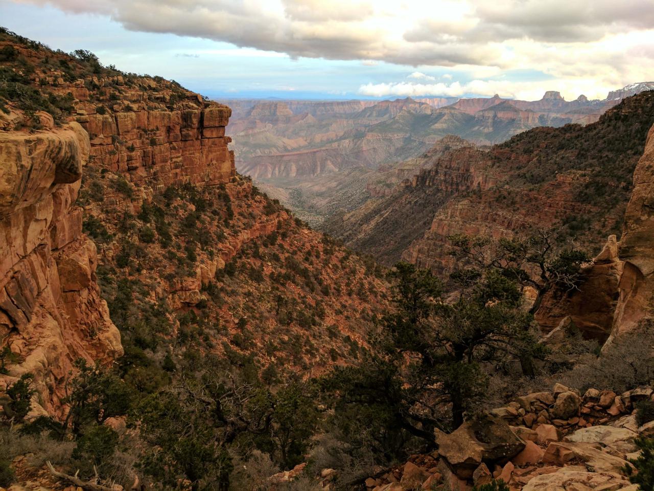
From the top of the trailhead, the steep, boulder-strewn switchback drops to the narrow ledge along the redrock of the Supai Formation. The trail is sandwiched between the towering cliff to the left and terraced plummets on the right for the next two miles to Marion Point, the first area wide enough to safely take off a backpack and rest. A simple slip in most places would send a hiker sliding down a steep 20-foot slope and then off a sheer 100-foot ledge.
Marion Point
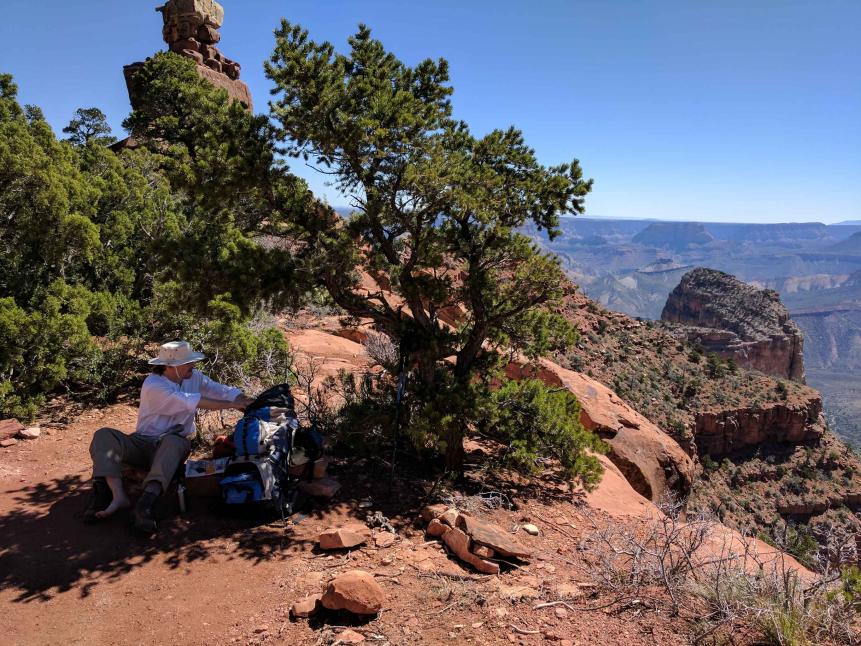
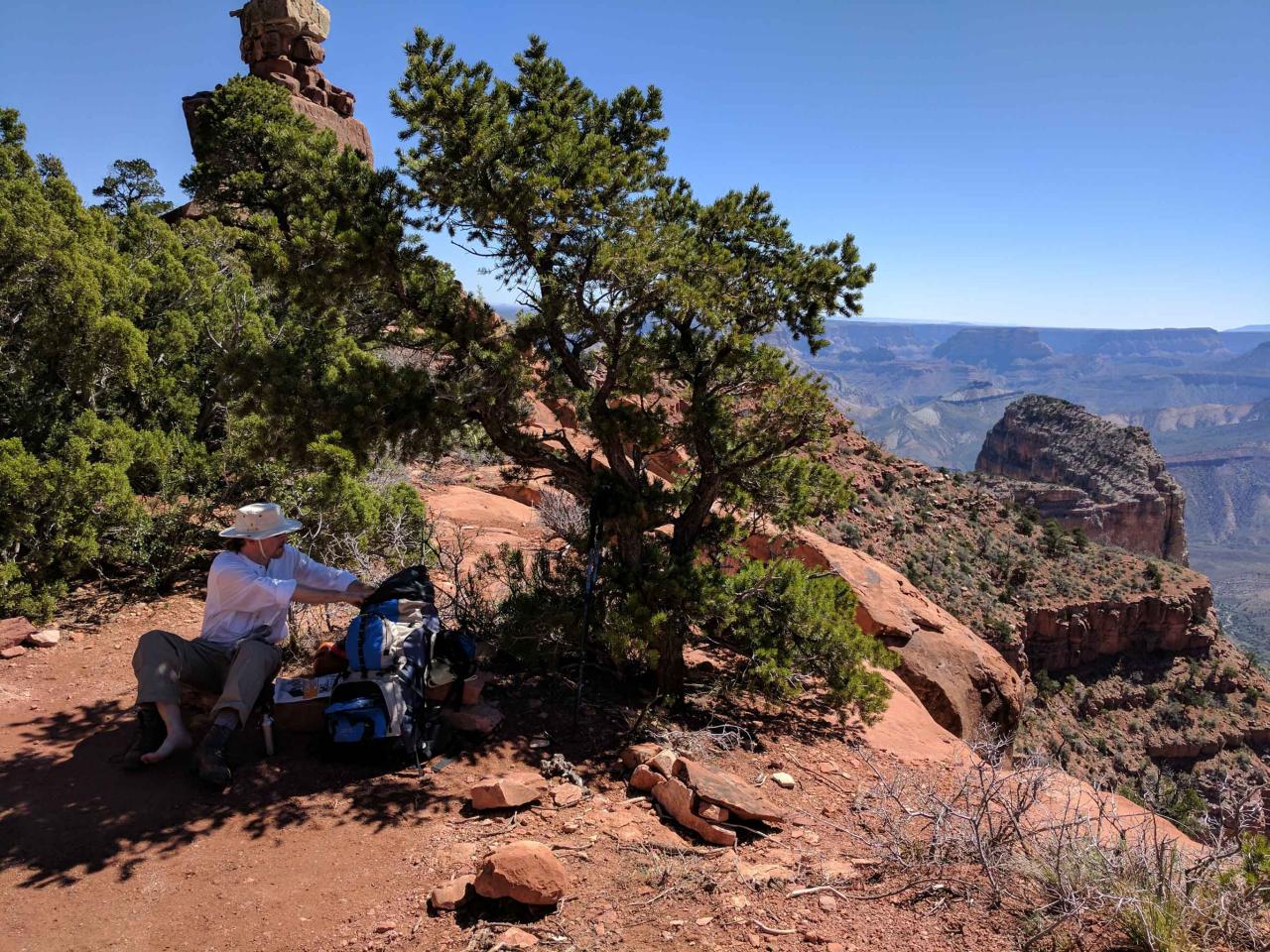
Steve Larese
Marion Point is one of the few places where hikers can take their packs off and rest along the Nankoweap Trail.
At Marion Point, there's a pinon tree that makes a good spot for a rest in the shade. Marion Point is also wide enough to set up a tent, but the favored camping spot is at Tilted Mesa three miles away. It's tempting to spend a lot of time at Marion Point resting and taking in the incredible view of the Grand Canyon, but there's still a long day ahead, especially if your plan is to make it all the way to Nankoweap Creek on the first day. The only other safe places to camp are at Tilted Mesa in three miles (eight miles from the parking lot), or at the creek in six miles (11 miles from the parking lot). Average hiking time is less than one mile per hour. About 100 meters past Marion Point is a dripping spring marked by green vegetation. This is not a water source to rely on, but some hikers pack in containers to leave under the drips. The containers fill with spring water (that still needs to be filtered) for the return trip out.
Tilted Mesa
Steve Larese
Campsite on Tilted Mesa.
The thin, sloped trail that skirts drops of hundreds of feet continues for three miles past Marion Point to Tilted Mesa, and the descent to Nankoweap Creek. There are several eight-foot-high down climbs to make here, and hikers are aided by the remains of juniper trees. There are a few level camping spots on Tilted Mesa, and unless you have about four hours of daylight left, it's advisable to camp here for the night and not get caught on the descent in the dark toward Nankoweap Creek.

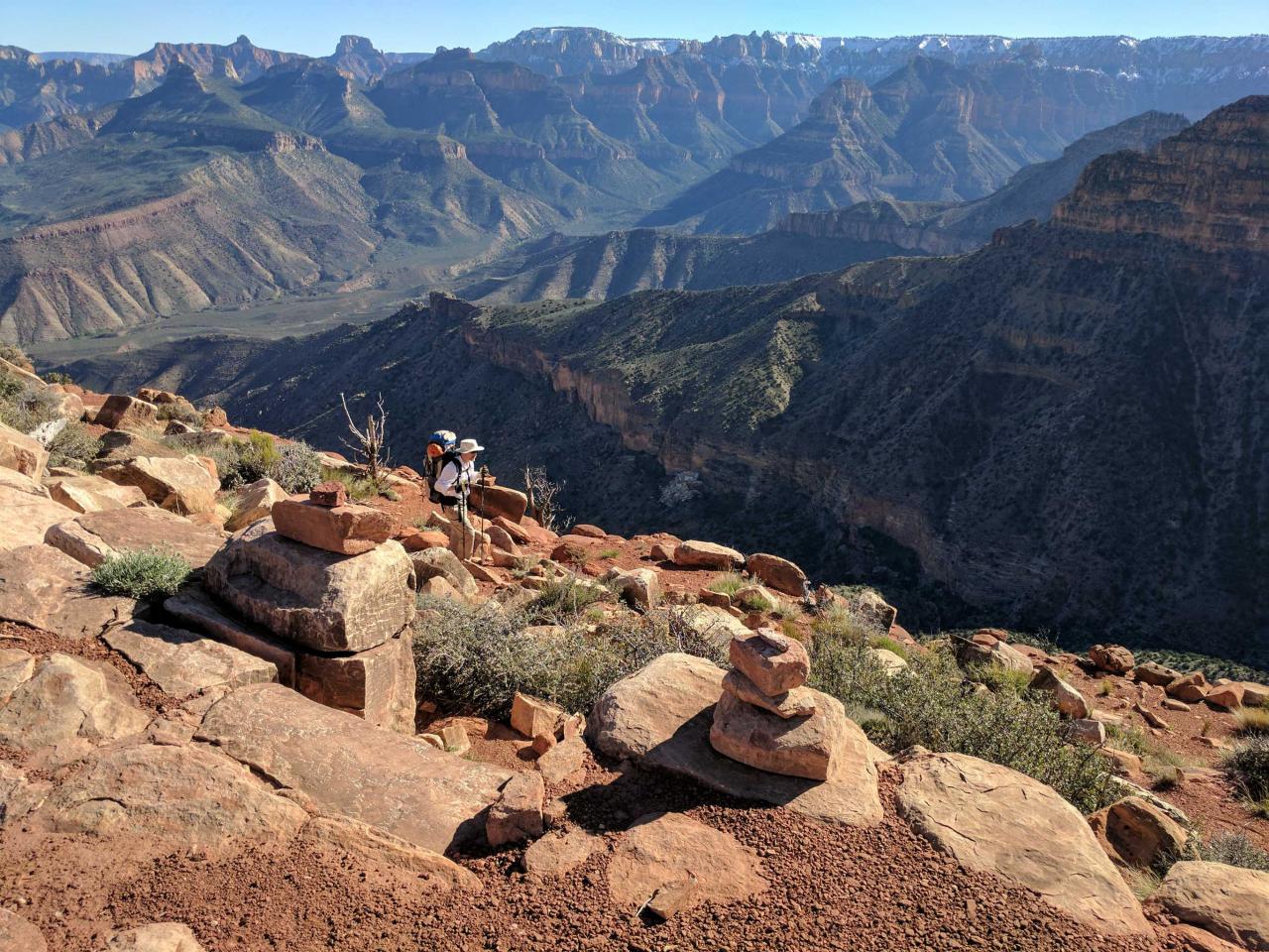
Steve Larese
Cairns mark the descent down Tilted Mesa.
As always, manage your water. It's three slow-going miles from Tilted Mesa to Nankoweap Creek. There are thin switchbacks, followed by a very steep angled descent down the edge of a scree ridge for about a mile, and crush shale makes this section very unstable. Hiking poles are recommended all along this trail.
Nankoweap Creek

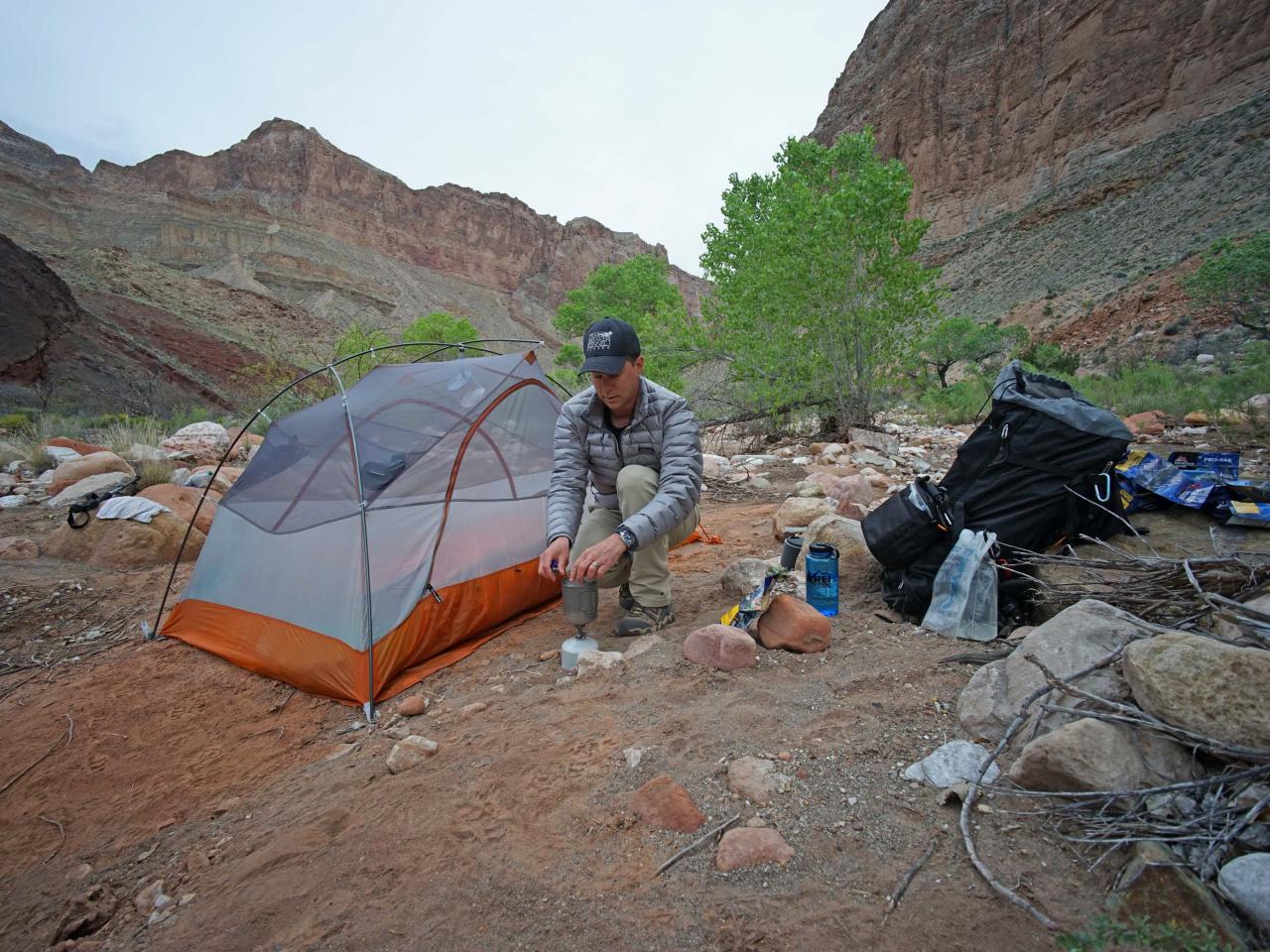
Steve Larese
Campsite along Nankoweap Creek.
Eventually, the trail levels out onto the desert floor and cairns mark the way through cactus patches. The trail drops into a dry, sandy creek bed that leads to a drop into a thicket of willows and grapes. The sound of Nankoweap Creek can be heard just beyond. While the trail is poorly defined here, explore to the left and a path through the thicket will be found. The path opens out onto the rocky beach of cottonwood-lined Nankoweap Creek. A large cairn marks the way back to the trail for the return trip. This area makes an excellent camp site, or hikers may follow the creek for three miles downstream to other beach campsites at the Colorado River, which are sometimes occupied by river rafters.
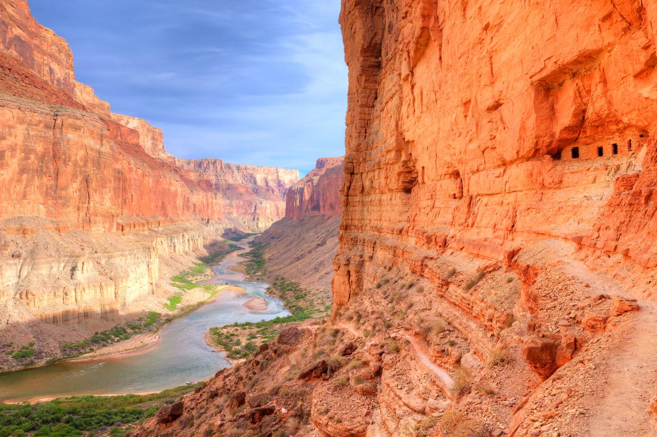
The Colorado River + Nankoweap Granaries

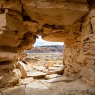
tonda
The Nankoweap Granaries above the Colorado River were built by Puebloans 900 years ago to store grain that was farmed below near the river.
Just before reaching the Colorado River, there's a spur to the right that leads 500-feet up Nankoweap Mesa to the famous Nankoweap Granaries. These cliff ruins were constructed by the Pueblo people who lived here approximately 900 years ago. They were used to store corn and other crops in a spot that was hopefully inaccessible to rodents. Overlooking the Colorado River below, this is one of the Grand Canyon's most iconic views.


