


GettyImages/Kip Evans
Wildfire Technology: Tackling the Spread of Wilderness Fires with Digital Tech
From the Amazon basin to northern Siberian forests, the wildfires are spreading. However, the technology used to tackle large area fires has become more sophisticated to respond to this threat.
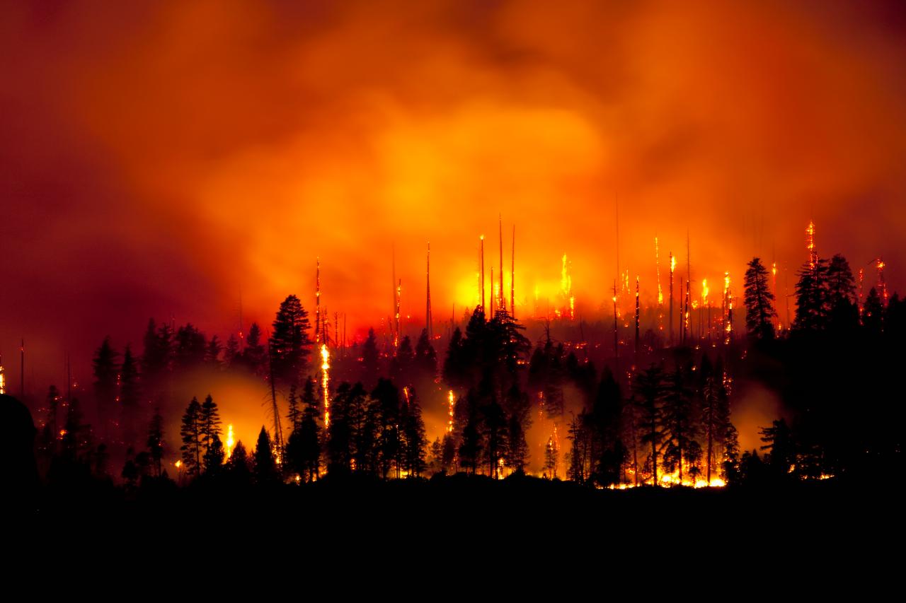
Wildfires are among the most destructive forces on Earth. When these fires burn into towns and cities on the edges of forests or wildlands, the economic damage and potential loss of life can be massive. Meanwhile, hotter global temperatures and extreme heat waves increase the danger from wildfire spread.
The technology used to tackle large area fires has become more sophisticated to respond to this threat. Firefighters form highly-trained ground and air teams. Helicopters and air tankers carry water, suppressant foam, and flame retarding chemicals direct to fire hotspots.
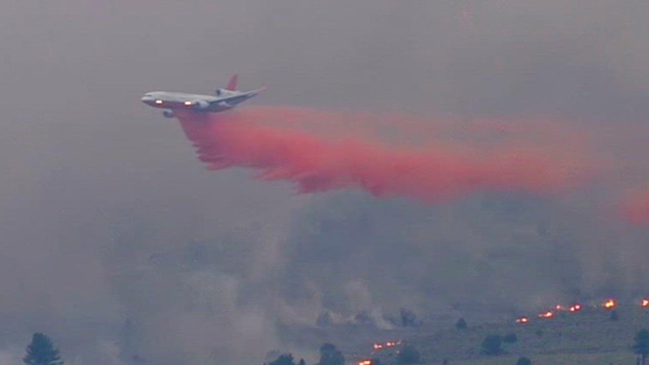
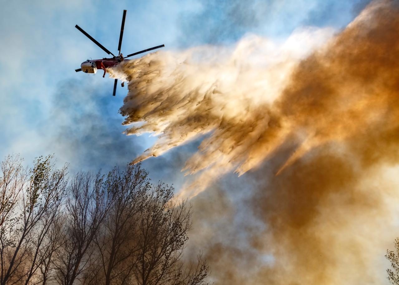
Teams tackling the California wildfires used the Global SuperTanker – a modified jumbo jet that carries almost 73,000 liters (19,200 gallons) of fire retardant – alongside the S-64 Aircrane heavy-lifting helicopter, which carries 10,000 liters (2,200 gallons) of water.
These air tankers are used to put out flames and monitor fire spread through sensors and video feeds coupled to GPS data. Fed into sophisticated computer modelling software, they can help predict the fire's behavior and possible spread patterns. Computer models are able to provide small area coverage only meters wide, mapping terrain and airflow. Fires are especially responsive to wind conditions and these tools allow firefighters to determine the passage of flames at ground level.

GettyImages/David Toussaint
But manned aircrafts need a large investment in maintenance and crew training. Command and control centers are turning to unmanned aerial vehicles (UAVs) to keep costs down and provide additional capabilities. Small quadcopters and larger fixed-wing aircraft can fly over fires for much longer periods.
Smoke can obscure the ground for days at a time or pose a severe inhalation risk to air crews – However, this is not a problem for drones. Onboard high definition, infrared and thermal imaging cameras can provide direction to ground teams, spot vital infrastructure (including power or water lines), and identify dangerous or flammable objects.
Infrared and thermal cameras can see through smoke to monitor ground teams and let them know when conditions change. UAVs can provide georeferenced aerial images, heat maps, and temperature scales of fire zones. Specialist drones can even carry hoses to less accessible areas. In the future, swarms of autonomous drones could be used to track wildfires and spot fire spread.
Thermal imaging technology has become widespread and less expensive to use. Handheld cameras and devices that attach to smartphones allow firefighters to see through smoke and find active fire hotspots, or undergrowth that is burning without producing smoke.
Identifying these hotspots allows crews to target the most active and dangerous parts of a willdfire and divert manpower to tackle it more effectively.
From the Amazon basin to northern Siberian forests, the problem is spreading. Hotter dryer conditions mean wildland fires are more likely to spread in regularity and scale. Professor Johann Goldammer, a leading authority on wildfires and director of the Global Fire Monitoring Centre (GFMC) at Germany’s Max Planck Institute of Chemistry, says climate change is creating longer, more severe fire seasons.
“A region like the West Coast of the US is experiencing an increasingly longer fire season that now seems to be all year long,” said Prof Goldammer.
Human behaviour is adding to that risk, he added. “We are modifying the land by clear cutting, inhabiting, entering, industry, agriculture and so on. With this, the fire regimes and the vulnerabilities of ecosystems are changing.”
From January 1 to July 30, 2019 there were 25,619 wildfires in the US, according to the National Interagency Fire Center. Some 3.2 million acres were burned in that period. In California alone, there are more than two million properties at high to extreme risk from fire damage.
In 2018 the Camp Fire in northern California became the deadliest and most destructive fire on record in the state. At least 88 people died and 18,800 structures were destroyed. The economic losses were estimated at between $8.5 billion and $10.5 billion.
For the crews tackling these blazes the risks are high too. Air crews are regularly prone to incidents and 24 per cent of firefighter deaths betwen 2006 and 2016 were due to plane and helicopter crashes. This highlights the wisdom of expanding drone fleets to provide support to fire teams.
Other technologies that can save lives include surival items like fire blankets. Often the last line of defense for trapped firefighters, a Sunseeker fire blanket can withstand temperatures of 3,000 degrees fahrenheit. First response firefighters who parachute into wildland fires – known as smokejumpers – are among those who need them most.
Their training at the US Forest Service now includes the PARASIM virtual parachute jump simulator to practice for real-life situations. PARASIM provides the same performance as a parachute – where trainers can change wind speed, weather conditions and terrain types – inside a realistic 3D simulation.
Augmented reality helmets that include breathing apparatus alongside computer vision-aided displays are adding to the ground team's capabilities. Thermal cameras inside the helmets mean that firefighters can operate in environments completely obscured by smoke. At the same time they can wirelessly transmit information on what is happening at the frontline to command and control points.
Robots are also making a difference. The Smokebot was developed by a Swedish university to assist fire and rescue services. It collects data in environments with reduced visibility using radar, a laser scanner, a thermal camera and gas sensors. Smokebot can help in forest fire situations mapping large areas filled with dust or smoke, where it is too risky to send in rescue personnel.
Finally to get the bigger picture on fire tracking and monitoring, the US Forest Service and US Geological Survey uses data from the Landsat Earth-observing satellites. Data gathered from every major fire in the country since 1984 has been fed into computer models to help predict and prevent wildfires.
Forest thinning and controlled burns are used to eliminate fuel sources before they can ignite. "We use the satellites to inform decisions on where to stage assets across the country," said Brad Quayle of the Forest Service’s Geospatial Technology and Applications Center. "When there’s high competition for firefighters, tankers and aircraft, decisions have to be made on how to distribute those assets."
Earth-observing satellites commonly detect wildfires in wilderness areas. Their cameras and remote sensors are used to estimate the fire's evolution and provide situational awareness that saves lives.
The Visible Infrared Imaging Radiometer Suite (VIIRS) onboard the Suomi NPP satellite gives near real-time data to NASA's Fire Information for Resource Management System (FIRMS) on active fires across the world.


 Opens In Beijing")