


Vicki Smith
Wildfire Challenge: Growing Investment in Firefighting Technology
Tackling rapid and destructive wildfires before they can spread over wide areas is one of the most pressing challenges for firefighters today.
Harnessing technology to spot and prevent fires could save not only wild habitats and native species, but prevent fatalities and save billions of dollars in clean-up and rebuilding.
Regions with dry, arid conditions, where consecutive periods of drought prevail, can experience huge losses of forest, grassland, property, and agricultural land to runaway fires. Better land and forest management along with improved house building plans, using fire-resistant designs and materials, and controlled burns to remove wildfire fuel, are essential measures.
But spotting wildfires using linked camera networks could become one of the backbone technologies for tackling blazes. Wildlife organizations already use motion-detection cameras to track different species in the wild. So using trail cameras to identify fires before they grow is a logical step.
Using the Past to Predict the Future

Grant Faint
California in 2018 experienced its worst wildfires in history, when more than 8,500 separate fires destroyed almost two million acres. Two wildfires formed the Mendocino Complex Fire to raze almost half a million acres alone, while the Camp Fire almost completely destroyed the towns of Paradise and Concow, killing more than 80 people.
In response a Californian electricity supplier installed 161 live feed cameras and opened viewing to the public to report fires. The network joined a wider inter-state initiative between universities in Idaho, Oregon, and California to form ALERTWildfire – a series of state-of-the-art pan-tilt-zoom cameras that rotate 360 degrees to spot fires, track their spread, and rapidly direct firefighting resources.
In three years, the network has been involved in monitoring nearly 900 fires. “We can see second by second what’s happening 24/7/365,” said ALERTWildifre director Graham Kent. “The old way of doing business, putting people on top of a mountain to look for fires, might still work to a good degree, but this new technological approach is tough to beat.”
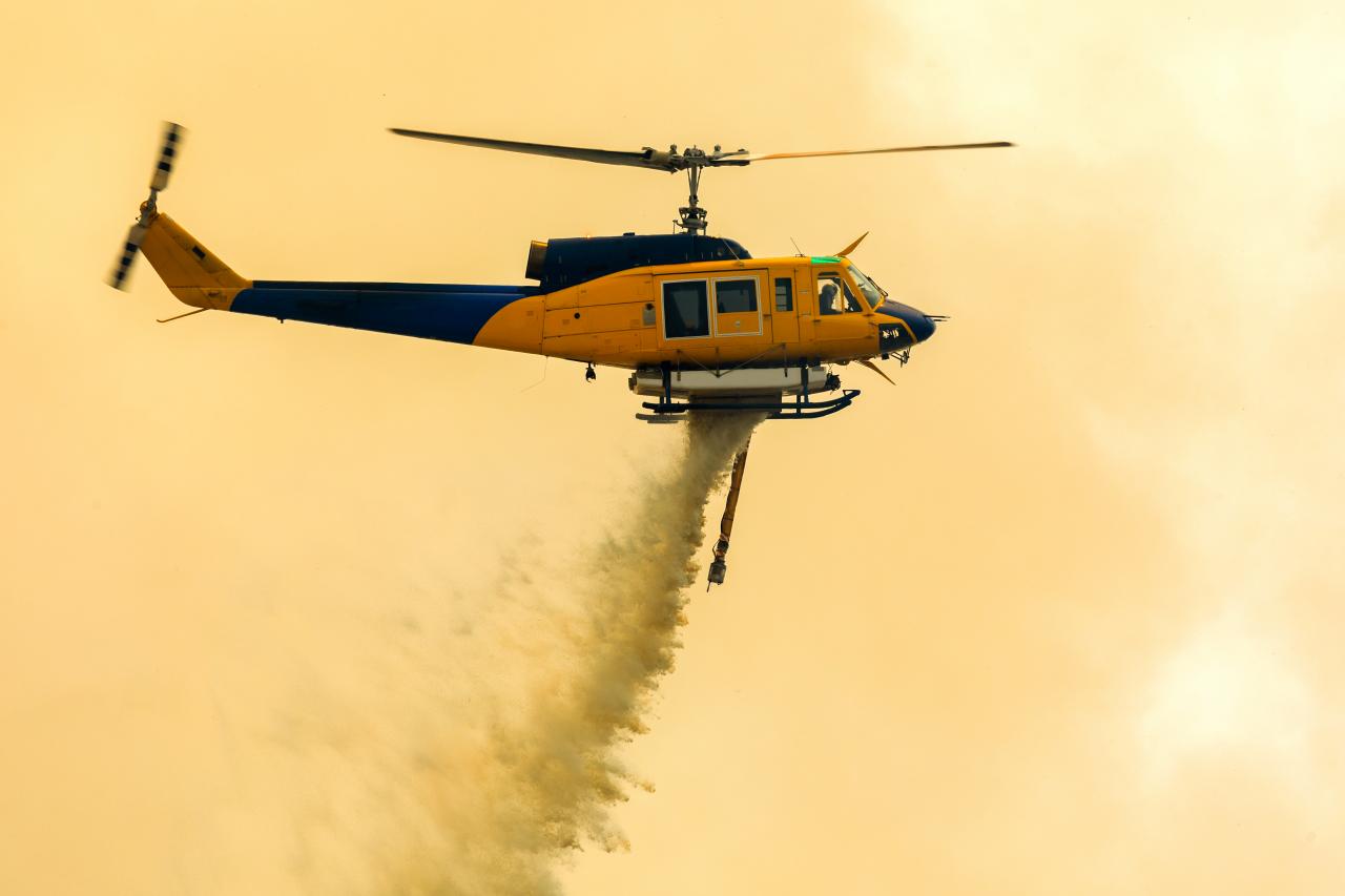
Cameras to the Rescue
Early estimates suggested the camera network could reduce fire damage ten times more effectively. Adding in infrared cameras and night vision goggles then allows crews to spot heat signatures in a single tree or pick up the flicker of flame at night.
Thermal sensing capabilities mounted to aircraft and drones are able to scan miles of terrain at once and direct ground crews to target fire suppression. Heat signatures can reveal the presence of so-called ‘zombie fires’ – simmering underground blazes that burn for months at a time.
Oregon Department of Forestry aircraft have been fitted with thermal cameras and other night vision systems to see through thick clouds of smoke. But plane-mounted sensors are a relatively expensive resource. The increasing power of drone fleets that excel at mapping and data collection can identify areas that might be about to ignite and free up planes to move equipment, deploy firefighters, and drop water and flame retardants.
Monitoring the Situation from Space

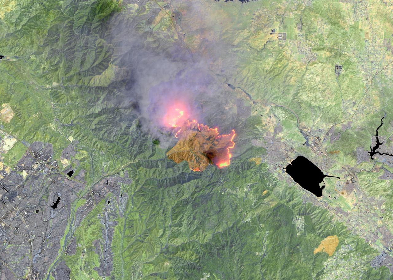
maps4media
HOLY FIRE, CALIFORNIA, UNITED STATES, AUGUST 18, 2018: This is an enhanced Landsat-8 thermal satellite image of the Holy Fire, in Orange County, east of Long Beach, California.
For years, the adoption of advanced satellite imagery has also contributed to early warning systems and firefighting capabilities. NASA satellites obtain high-resolution imagery from orbit. Landsat 8 captured incredible pictures of the smoke plume from California’s Holy Fire using its operational land imager.
NASA’s Suomi NPP satellite captures images of wildfires using its visible infrared radiometry suite. Data taken from years of satellite imagery will now be tied to machine learning models at Stanford University to create an AI that can improve wildfire prediction
The University of San Diego’s WIFIRE project also aims to train AI to predict the fire’s path in real time, using visual and spatial analysis to simulate what might happen next.
Firefighting teams are still struggling to cope with the impact of the coronavirus, but the heightened risks from wildfires require investment in prevention systems. Electrical transmission line faults were responsible for igniting the Camp Fire, so electricity grids need to be made more resilient, and faults detected more rapidly, using drones and advanced computing.
Ground-level firebreak technologies such as clean chemical spray to dampen blazes will add to the firefighter’s arsenal. Similarly, long-term research is crucial, including the University of Nevada, Reno’s five-year digital platform project that brings together atmospheric scientists and engineers with fire ecology and weather systems data and computer vision.
“This project exemplifies the engineering spirit,” said Dean of the University’s College of Engineering, Manos Maragakis. “Through collaboration, it provides multiple lenses for understanding a pressing problem not only in the United States but around the world.”

Global Wildfire Tech
From the Amazon basin to northern Siberian forests, the wildfires are spreading. However, the technology used to tackle large area fires has become more sophisticated to respond to this threat.


